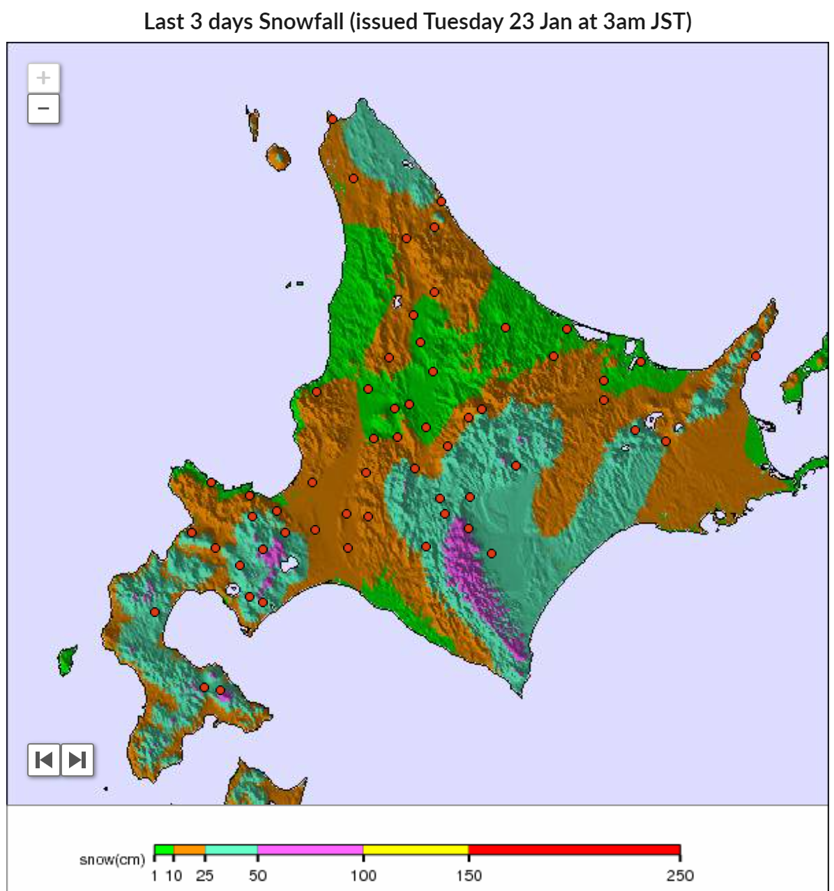
 Last 3 days snowfall model (snow-forecast.com)
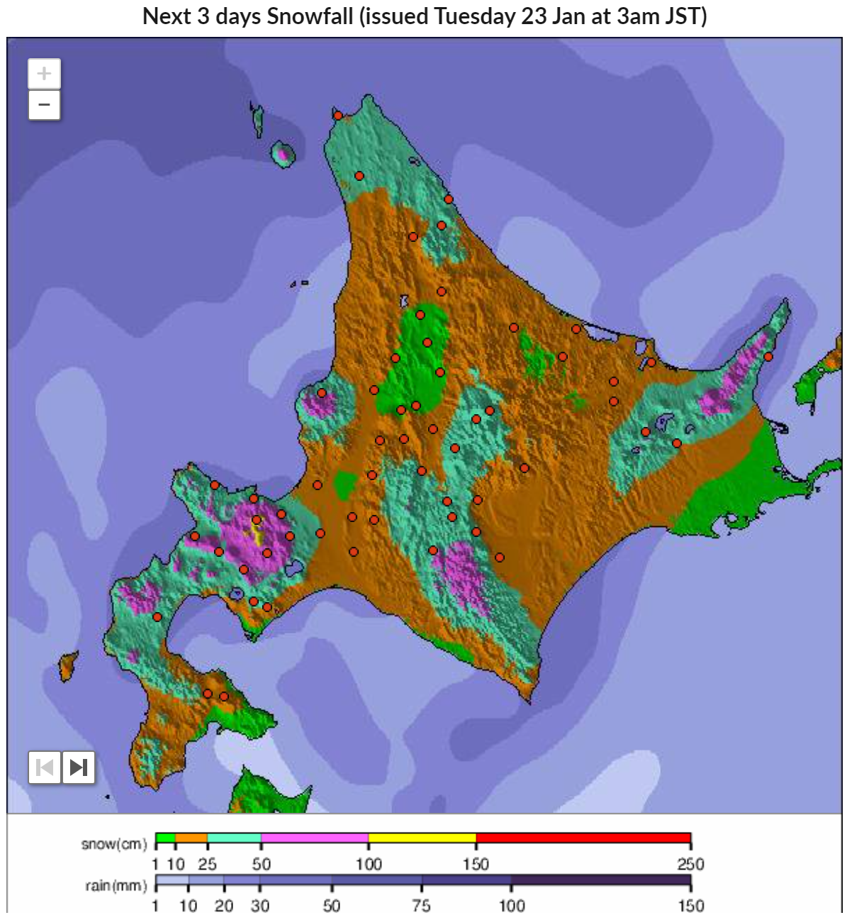 Next 3 days snowfall model (snow-forecast.com)
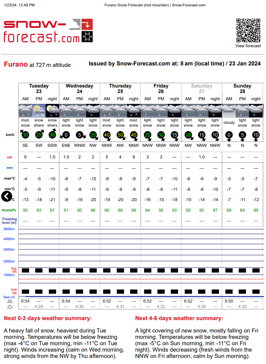
FAT の ライアン:
雪崩心配している。
日本語の記事がなくてすみません。 私は今、スキーシーズン直前で準備がとても忙しいです。 DeepLという翻訳サイトがとてもクオリティが良いので、使ってみて下さい: [https://www.deepl.com/translator]
Over the last week it has not snowed very much in the Furano Basin and stability was good. Since the last significant snow fall(20240115), there have been many sunny days, resulting in a firm temperature crust or simply denser than usual snow. Additionally, steep S-E aspects are quite suncrusted.
I ski cut/ triggered a size 2- wind slab on the S aspect of a steep sided gully on 20240117, but since then I have only experienced stable snow. On this same day, I was also surprised how many open creek holes were in the valley I visited. Glide cracks are also larger and more open than normal so, as usual, I will try not to crash into them or spend unnecessary amounts of time below them.
Yesterday, a storm blowing from the SE began to hit Hokkaido, resulting in more snowfall SE of Furano. It has snowed a little in Furano too with moderate - strong winds. It is difficult to tell exactly how much has snowed from my base here in the center of the Furano Basin as the winds have stripped all the new snow on the flat open farm fields around me yet filled in all my shin deep foot prints I made a few days ago.
I will refer to this new layer as the 20240122 layer and I would not be surprised if it is unstable. Mostly, I am concerned about Loading on N - W aspects in areas that are usually wind stripped. - As most storms are coming from the complete opposite direction, this may take many by surprise. For example, Tokachidake is usually stable being mostly windward facing terrain, but now there is loading on suncrusts. (I saw many brilliant sunsets on the west aspects of Daisetsuzan over the past week, hence assuming suncrusts)
Currently, there may be dangerous wind slabs on these loaded N - W aspects where/ if significant snow has accumulated.
Tomorrow afternoon, the 24th, the wind direction is forecast to switch to NW.
Significant snow is also forecast through the 25th with strong winds. - I anticipate this will almost certainly lead to unstable & dangerous wind slabs on SE aspects and possibly unstable storm slabs on all aspects.
Maybe my assumption of ‘High’ overall risk level in the banner of this blog post is conservative, but I won’t know until the 2nd half of this storm falls and get a chance to ski it. Likely I wont have time to update in the near future either. I won’t be surprised to hear about big avalanches in Central Hokkaido.
If the longer range forecasts are correct and it doesn’t snow after the 27th for a few days then stability should steadily improve from then.
Have fun, be safe & enjoy Furano!
Last 3 days snowfall model (snow-forecast.com)
Next 3 days snowfall model (snow-forecast.com)