Ryan from FAT:
日本語の記事がなくてすみません。
私は今、スキーシーズン直前で準備がとても忙しいです。
DeepLという翻訳サイトがとてもクオリティが良いので、使ってみて下さい: https://www.deepl.com/translator
Meri Kuri from Furano-shi, 200m ASL, where it is currently -2C!
The forecast is showing relatively stable weather and cold temperatures until the evening of the 28th. I believe it is a logical assumption that the snow stability is now improving until the next storm cycle arrives. There is a rain crust around and below 800m that may still be reactive. The main 2 issues to look out for in regards to avalanches are:
- The 20221223 rain crust layer around and below 800m that was previously reactive may still be reactive in places.
- The 20221222-23 storm came in initially with very strong winds from the SE, loading the NW slopes, which is opposite situation to usual.
I believe the avalanche cycle of this recent storm cycle is largely over but it is still important to be cautious considering these strong SE storms are not common. Crazy rotors from these intense storms can create anomalous pockets of wind loading and areas of instability in surprising places.
We still also have early season conditions with many exposed branches and hazards, and now, from the rain event, there are large frozen chunks of ice perched in trees and just below the fresh snow..
-—————————————————-
Summary of events that led to current conditions:
Prior to mid-December, backcountry skiing was not possible in most places due to lack of snow. Since then, much snow has fallen, often 10-20cm per day making for a good base. A record of the snowfall is best found on Furano ski area’s facebook page.
The recent 20221222-23 major storm that brought heavy amounts of precipitation (85kmph was forecast) to central and especially E Hokkaido started warm with the FL around 800m with strong SE winds. During and after the rain event there was a high risk of loose wet avalanches until the top of the rain. Many large avalanches occurred in the steep terrain of the Yubari Mountains.
The crust (20221223 layer) froze during and after the storm as the FL dropped and precipitation became denser snow. Initially, on the 23rd, there were 20cm reactive storm slabs on the 20221223 rain crust at a zone in the mid-elevations, all aspects, that have since become more stable. During and after the storm it was easy to skier trigger. Now it appears they are not as reactive but certainly still something to be wary of when skiing in avalanche terrain.
On the 20221224 I was guiding on the other side of the Furano Valley to the North in the higher elevation Tokachi Mountains of Daisetsuzan National Park. I spent much of my day around 1000m in a sheltered area. The 20221213 rain crust did not exist here, rather a dense wind packed layer, denser than the underlying snow making it difficult to ski in places. On the loaded NW aspect, this transition to lighter snow was deeper down making for better skiing conditions.
I would describe the conditions I found as ‘slabby’ with an upside down density profile. I saw little evidence of propagation at that elevation so it was not concerning at all, i.e. it was bonding well to the layer of less dense rounds beneath. However, I can imagine that the risk of slab avalanches would have almost certainly been higher in the alpine on the now loaded NW aspects that are often the firm, wind-scoured aspect.
Therefore, initially, there was likely a considerable risk of slab avalanches on those NW slopes. - I heard reports of shooting cracks in the mid-higher elevations.





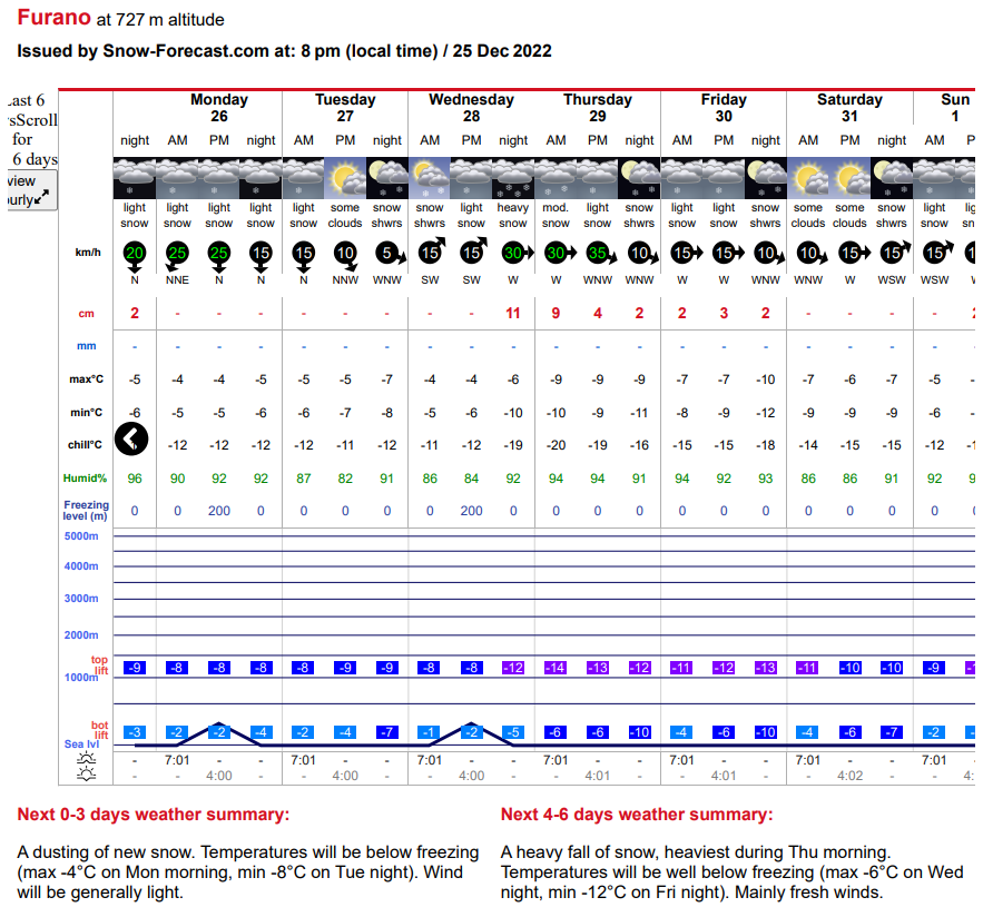 Current weather forecast showing stable weather for next 2 days
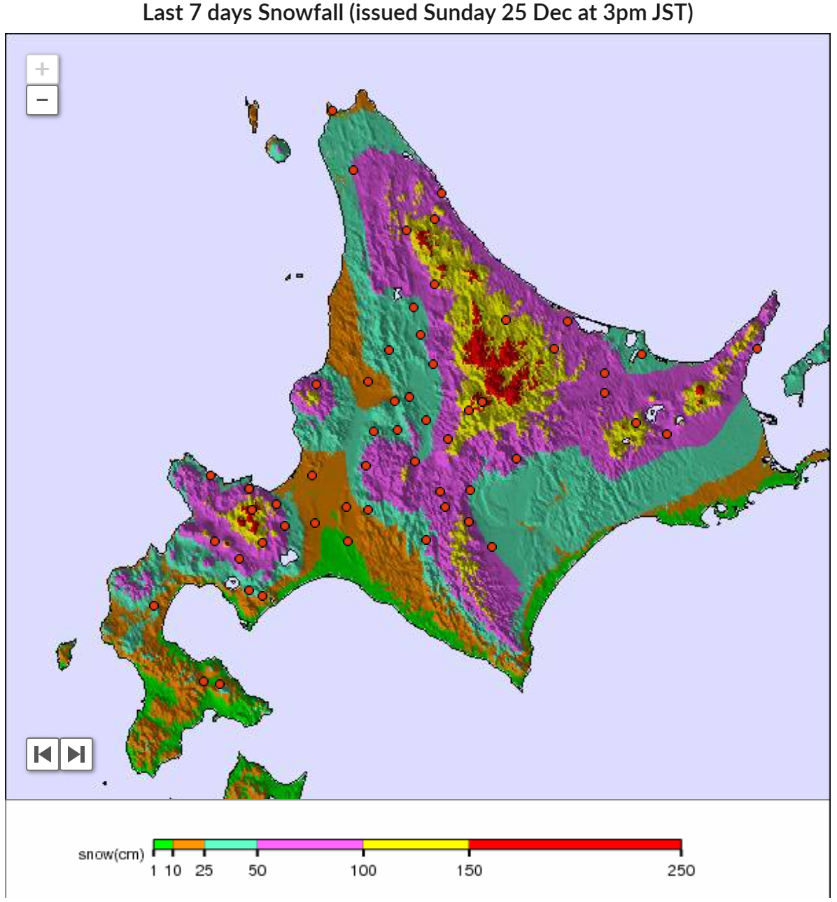 Model showing some very heavy snowfall over the past week.